| THE DEVELOPMENT OF AN AREA |
| BEFORE & AFTER THE NEW ESSO CLUB &
LONE PALM STADIUM |
| A GLIMPSE INTO THE PAST |
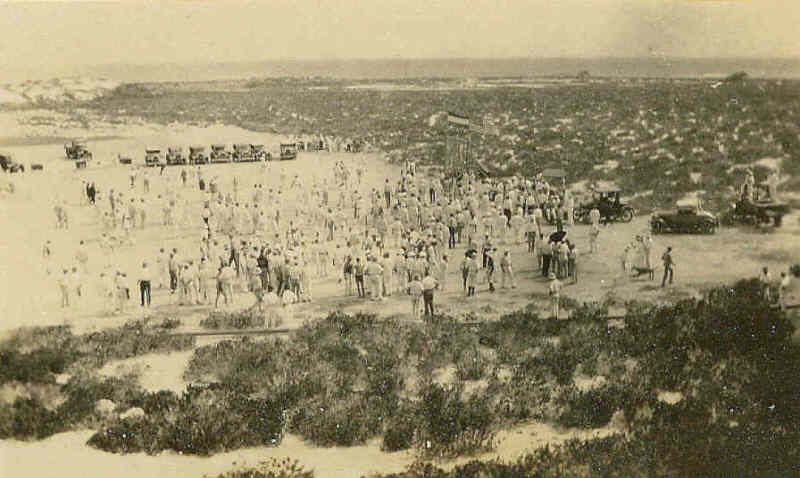
| I have been looking at these old photos and now
believe that this photo from Bill Moyer's scrapbook of a 4th of July
picnic in the very early 1930's (look at the cars) shows the area that
became Lone Palm Stadium and the New Esso Club in later years. The
salt pond shown in the second photograph can be seen in the background
of the first photo. The pipe line probably carried brackish water
from the Maga Cora wells above the area by Baby Beach and the Picnic
Grounds to the houses in the Colony. This photo was probably taken
from the cliff where the Big Steps were later built. |
| RECEIVED TODAY 7/31/2007
Looking at the hilly surroundings and the hard flat
surfaces, and possibly a bay in the background but no houses or refinery
in sight, I would almost dare to wager that this is not the area where
the Esso Club later was developed, but the Baby Beach / Picnic Ground
area. That had some dunes around it high enough for this photo. The big
steps cliff was higher than this and would show rock. The photographer
is standing on a sand hill/dune of probably about 5-8 meters height (and
there were one or two about that high in the picnic grounds area). The
shrubbery also looks more like the picnic grounds / animal cemetery
area. Assuming looking south-east (which fits with the shadows, assuming
an activity would be 1500 or later in the afternoon) the lower cliffs in
that area would be to the left outside of the picture, the lighthouse
also to the left outside the picture. You do see the sea to the right in
the background.
Arthur P. Meiners |
| Arthur Meiners may be
correct but I am not sure, I still think it is what later became Lone
Palm Stadium. Dan Jensen 7/31/2007 |
 |
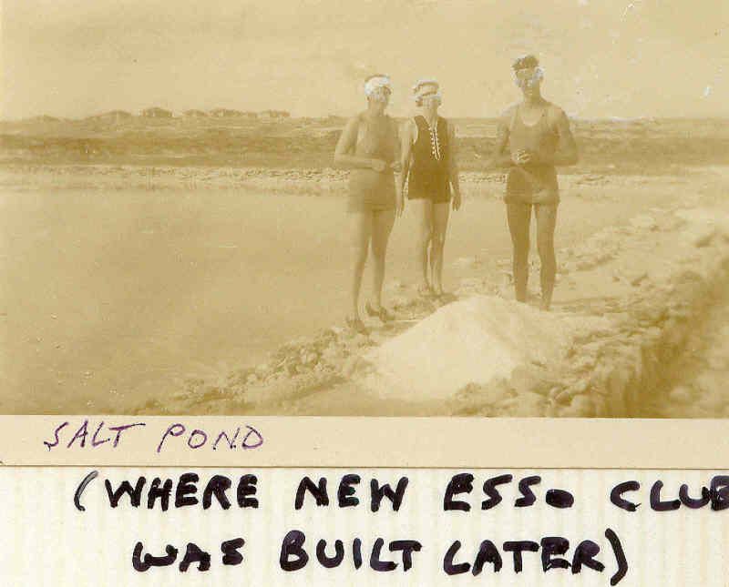
| This photo, also from Bill Moyer's scrapbook shows
a pile of salt and the salt pond. The notation in the scrapbook
says "where the New Esso Club was built later" and the early Colony can
bee seen in the background. |
 |
|
Thanks, Dan. I spent this morning taking a leisurely look through
your material, and am delighted and very impressed. I never would have
thought of enlarging the picture of the salt pond or the background of
the Paria Allen sailboat pictures, and couldn't even see background very
well in their small form. The enlargement of the 4th of July picnic
does indeed show the area where Lone Palm Stadium and the New Esso Club
were built. It never occurred to me to note the size of the sand dunes,
but of course they would have used the sand as fill. I was born in 1933
so was able to walk in that area in 1938 or so, and I distinctly
remember wading in the salt pond. The water was hot in the sun and the
salt stung your feet like crazy (even feet toughened by years of walking
on coral!) Also, the water was very light pink. I read that before Pan
Am Petroleum, Aruba natives supported themselves by fishing, raising
aloe, and collecting salt. There were probably salt ponds in various
other places, such as Sabaneta. When the army barracks were built down
there during WWII, the soldiers were from Puerto Rico (a Coast Artillery
battalion, I think.) Tinker and I used to hang out down there.
Maybe somebody else may send a correction. I never thought about the
pipeline coming up the cliff, but it must have brought brackish water
from a well down by the Dog Cemetery, as you said. Best regards, Bill
Moyer |
|
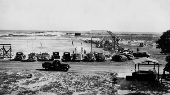
The photo below of Lone Palm Stadium was taken before World War II
and comes from the E-Bay Scrapbook. Not backstop and some
bleachers were built. |
 |
|
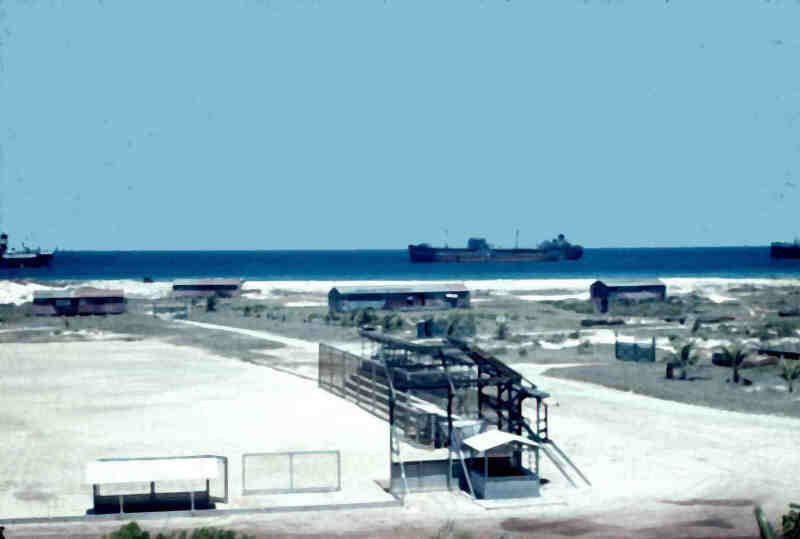
The next two photograph by Homer Waits were taken
in the mid 1940's. Both these color photographs were taken from
the top of the Big Steps. Homer went to Aruba in 1943, the first
shows Lone Palm Stadium and the Army barracks in the background, before
the New Esso Club was built. Note the sand dunes, they seem
smaller in this picture above than in the first photograph, the sand was
probably used to fill the salt pond. It may also be the angle of
the photograph, hard to tell. |
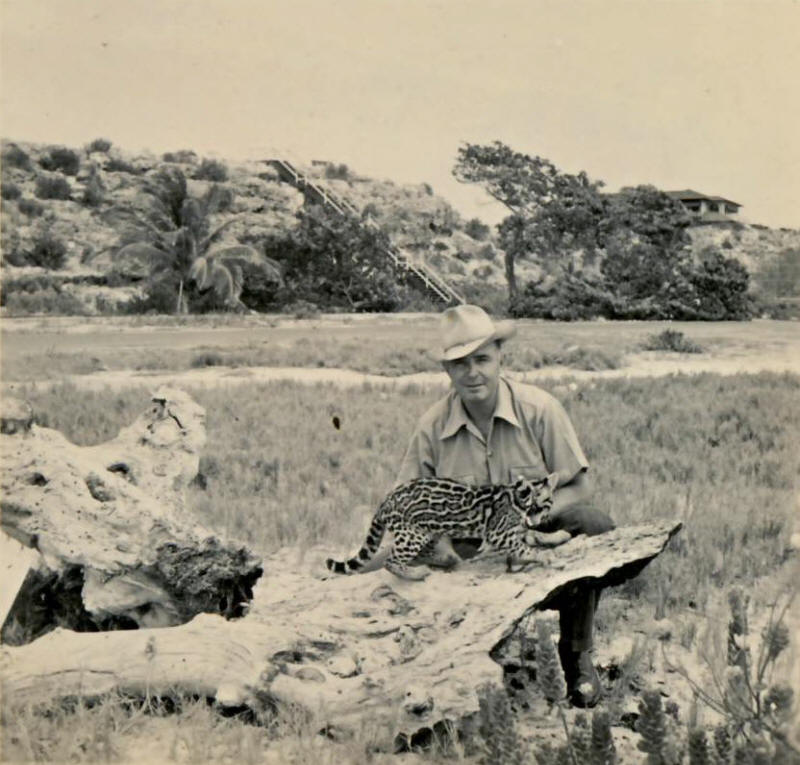
August 8, 2007. Today I received an
email from Vic Lopez with a photo of Don Blair and his pet ocolet.
This was the question.
Note the steps
in the background from high up to down where he is. Is this the
Rodger’s Beach area or Lone Palm Stadium area?
Photo is from
1938 or 39.
|
|
This is the photo Vic sent.
 |
|
I answered that the photo was from what
became to parking lot for Lone Palm Stadium and the New Esso Club.
The steps were made of wood at the time of the photo but were redone in
concrete after the New Esso Club was completed. This is another
good example of how much the area changed. Thanks Vic. |
 |
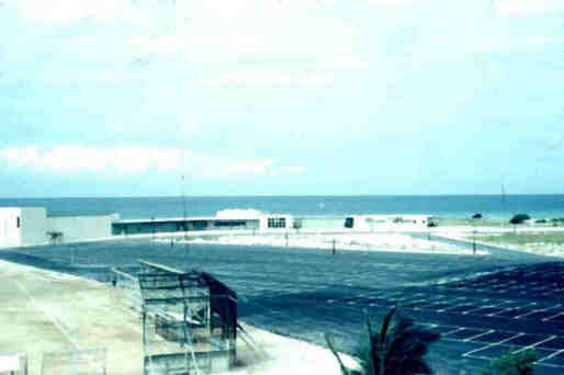
| And finely, the same area with the New Esso Club
in place and all the parking. I may be all wrong about this but I
believe this outlines the development of the area. Your comments
are welcome. |
 |
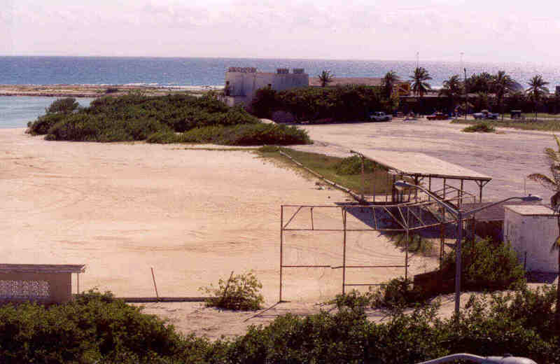
| And the final photo, by Steve Fremgen, taken in
2005. The sand dunes are gone after the hurricane. |
 |